


A contour survey is a land survey that measures elevation changes across a site and converts them into contour lines on a map. It helps builders, architects, and engineers understand slope, drainage direction, cut-and-fill needs, and terrain risks before construction begins. This matters because poor site-level planning can lead to water stagnation, excess excavation cost, unstable slopes, and foundation issues. This guide explains contour survey meaning, purpose, methods, tools, map-reading basics, advantages, limitations, applications, and construction checks. Brick & Bolt explains that contour surveys help visualise terrain and support earthwork, drainage, and structural planning.
Quick Answer
A contour survey measures ground elevations and shows them as contour lines that connect points of equal height. It is used for site planning, slope analysis, drainage design, earthwork calculation, foundation planning, road alignment, and regulatory approvals. Close contour lines show steep slopes, while widely spaced lines show gentle or flatter land.
What is a Contour Survey
A contour survey is a specific type of land survey that involves measuring and mapping elevation across a particular area. The resulting product is a contour map. A contour map is simply a flat representation of the surface of the earth and contour maps depict it in terms of lines, with contour lines joining places with the same height above sea level within the map area. Each line comes with a specific height, and the spaces between the lines indicate how steep the slope is. When the spaces are close to each other, the terrain is steep while where the spaces are far apart it means there are gentle slopes.
Unlike boundary surveys which determine the property lines, or topographic surveys which include vegetation and manmade structure, contour surveys concentrate on the shape and height of land. This focus makes them invaluable for construction planning as they indicate slopes, drainage, potential hazard sites, and other critical construction details.
Importance and Purpose of Contour Survey
In construction, there are specific reasons why contour surveys are important:
1) Feasibility Studies and Site Selection:
Prior to the commencement of any work, a contour survey outlines a site’s steep slopes, flood-prone, and unstable ground to ascertain its suitability for the specific project. This allows engineers to evaluate what challenges and risks need to be addressed.
2) Earthwork Preparation:
A contour survey profile having indexed elevations aids in estimating the amount of soil to be moved (cut and fill) during grading and excavation. This data is vital in enhancing efficient material moves, costs incurred, and environmental effects.
3) Designing Control Structures:
The engineers use contour maps to design efficient stormwater systems so that they do not accumulate or erode over time.
4) Design Alignment for Works:
The collection of information for contour surveys aids in the planning of roads, pipelines, utilities, other engineering works and structures so that they follow the general contours of the land reducing land disruption.
Conducting a contour survey helps reduce the risk of adverse outcomes in terrain control works. Accurate contour maps enable designers to manage slope stability in areas prone to geomorphological changes and precisely identify irregular settlement zones.
In Simple and Practical Words:
- As regards Earthwork and Grading: Maps of contours assist in determining the area to be excavated or where soil should be added in relation to a certain grade.
- Drainage Design: Engineers can construct systems to inhibit water trapping and erosion by recognizing the layout of natural drainage systems.
- Foundation Design: Designing safe and stable foundations requires knowledge of soil slope and terrain stability.
- Infrastructure Coordination: The positioning of roads, utility lines, as well as other constructions can be done in a manner that reduces environmental interference.
In relation to construction, surveys such as border contour surveys should be indicated on documents verifying the right of ownership on plots of real estate parcels.
How Contour Survey is Performed
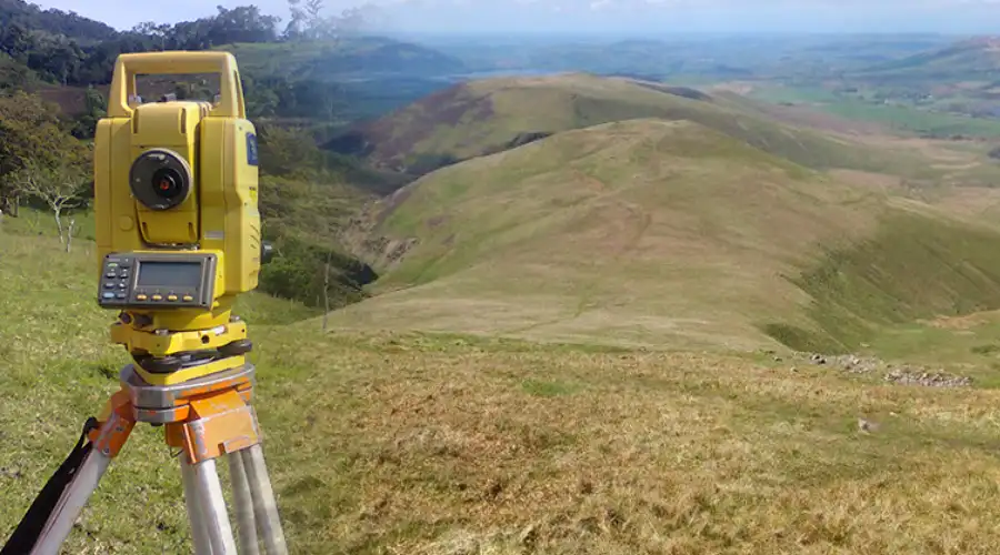
The procedure of carrying out a contour survey includes a few essential steps:
1) Site Observation:
The survey team goes through the site for the preliminary inspection in order to determine some of the key features and obstacles, as well as places of interest that are of significance. Every focus regarding the information has ensured forward is addressed.
2) Reference Points:
A set of control points or reference points which are known as control points are set up throughout the site. These control points allow the survey data to be tied to a known coordinate system for accuracy and reliability. Usually, control points are established using GPS, total stations or other preexisting benchmarks.
3) Data Collection:
Capture points, also called spot elevations or survey points, are collected to represent variations in elevation across a surface. Elevation points are captured at key terrain changes or regular intervals to accurately represent the surface and generate contour lines. Total stations, GPS, drones and LIDAR can nowadays capture data accurately and swiftly. For nonreachable large spaces, lidar or drones are very convenient as they have the ability to collect millions of data points in a brief period of time.
4) Data Processing:
The raw data is first imported into specialized software, where it is classified to distinguish ground points and interpolated to fill gaps. A surface model is then created using methods like TIN or gridding, from which contour lines are automatically generated at specified intervals. The results are validated by cross-checking with known benchmarks and checking for errors or anomalies.
5) Map Generation:
Contour lines are drawn, connecting points of equal elevation. The final map is used for design, planning, and regulatory approvals. Advanced software can also create 3D models of the terrain, providing an even clearer visualization of the site.
Tools Used in Contour Surveys:
- Total Stations: Total stations are examples of modern surveying instruments which automatically compute horizontal and vertical angles, in addition to distances.
- GPS Receivers: Position data, particularly in clear areas, is best obtained with these devices.
- Drones: Drones, fitted with cameras or LIDAR sensors, are capable of surveying large or hard-to-reach sites in minimal time.
- LIDAR: Using laser pulses, LIDAR devices measure and gauge distances to provide detailed elevation models for use in topographical analysis.
- Levels and Clinometers: These are older devices meant for determining the vertical angle of an object or structure.
Pros and Cons of Contour Survey
Advantages:
Accurate Data: With the aid of contour surveys, particular elevation features can be noted that serve the purpose of designing the foundations, roads, and drainage systems.
Efficient Planning: Knowledge of a site assists the construction team in streamlining material movement and minimizing earthworks.
Risk Lowering: Early identification of possible risks prevents costly mistakes, but more importantly, guarantees the safety of the workers and future occupants.
Compliance: Surveys of this nature are necessary as part of the application process in many jurisdictions, ensuring that projects are carried out with regard to the environment and safety.
Disadvantages:
Professional Skill and Apparatus: The equipment and personnel needed to conduct a contour survey are not available to all teams, which is a major drawback.
Time and Expense: Even with modern technology, contour surveys can still consume a lot of time and money compared to basic surveys. For larger or more complex sites, the disparity is even more pronounced.
Data Accuracy: The technology used and methodology affects the data quality of the survey. Data collection or processing errors greatly affect the accuracy of the final map.
| Pros | Cons |
| Accurate topographical data for design and planning | Requires skilled surveyors and specialized equipment |
| Supports efficient earthwork and drainage planning | Can be time-consuming for large or vegetated sites |
| Reduces project risks and costs | Higher initial costs compared to basic surveys |
| Enhances site safety and regulatory compliance | Data accuracy depends on survey methodology and equipment |
How to Create a Contour Map
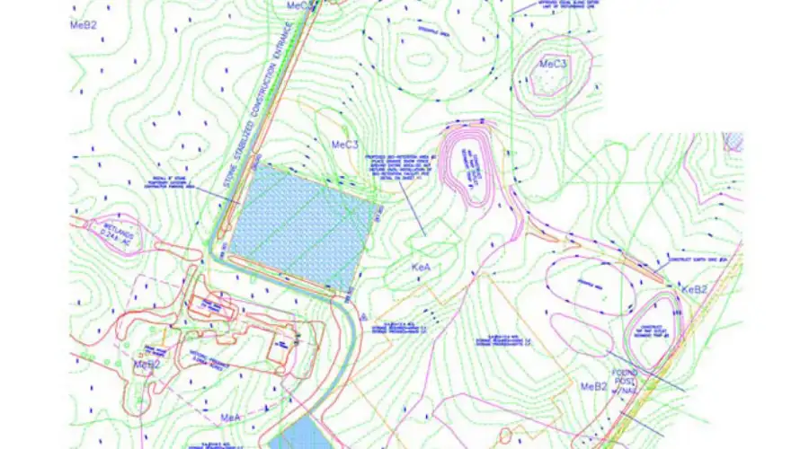
Two approaches exist for creating contour maps: direct and indirect contouring. Both methods have their pros and cons that cater to different types of projects.
Direct Contouring
Process: Surveyors go to the site and directly mark and measure the level curves with the use of a level and rod. A surveyor walks along the contour line and marks all points of interest with a rod.
Accuracy: As all contour lines are drawn along each equidistant contour level surface, the mapping of Direct Contouring is very accurate.
Application: Best for small sites where high accuracy is required such as small scale landscaping, building foundations etc.
Equipment: Levels, plane tables, theodolites, and Abney or hand levels.
Limitations: Handwork diagonal contour maps result in insufficiency for large or complex sites.
Indirect Contouring
Process: In indirect contouring, elevation is determined from both horizontal and vertical distance from the origin and elevation is taken in increments. With the received data, corresponding contour lines are drawn through interpolation. This approach is best suited for more exposed areas with more territory to cover, or when combined with rough terrain.
Accuracy: Whenever there is a need to lower precision while still holding some level of accuracy in construction, indirect contouring will work perfectly most of the time. Less precise compared to direct contouring, is more useful when there is a reason why too many dense data points are collated.
Application: As long as the target space or object comes in large sizes and complex shapes, indirect contouring is the right option. Works very well when contouring the visually incredible whole zones of roads, air flight strips and even in large development sites.
Methods:
Grid Method subdivision gives the opportunity to improve efficiency for different scaled grids or spaces. One can carve out 5m x 5m or even 20m x 20m in measuring cubical. For more ease, the grid could be even further subdivided.
Cross-Section Method: Bound slightly straighter borders that allow contouring on less expansive coverages, like around a linear for example, a road section.
Radial Line: Best for hilly convolving plains immersed in positioned terrain. Most useful guides come from the center inwards, the marked levels go further radiatively wider away from the center.
Equipment: total stations for satellite monitoring, Drones for angled watching, theodolites for gyro and picture lenses, GPS, even.
Limitations: The interpolation strategy is helpful for increasing the pace, but can result in bringing in small miscalculation and estimation problems, especially for sparsely populated areas.
How to Read a Contour Survey?
Understanding topographic maps lies at the heart of a construction specialist’s work. Consider the basic rules of contour survey:
- Tightly Spaced Contours: Represent steep slopes. The closer the lines are together the more a steeper area of land.
- Widely Spaced Contours: Indicate a gentler slope or flat land.
- Close Circles: Indicate a hill (if elevating upwards) or a depression (if goes down).
- V-Shaped Contours: Outlined drainages or valleys, pointed upstream.
- U- Shaped Contours: Outlined ridges or spurs, pointed downstream.
Conclusion
A contour survey is a valuable planning tool for construction because it shows how land rises, falls, drains, and changes across a site. It supports foundation planning, earthwork calculation, drainage design, road alignment, landscape grading, and risk reduction. Direct contouring gives high accuracy for smaller sites, while indirect methods using total stations, GPS, drones, and LIDAR are useful for larger areas. A reliable contour map helps designers work with the natural landform instead of fighting it. For sloped, uneven, or development-sensitive plots, a professional contour survey should be completed before final design.
FAQs
- What is a contour survey?
A contour survey is a land survey that measures ground elevation and represents it using contour lines. These lines connect points of equal height and help show slopes, valleys, ridges, drainage paths, and level differences across a construction site. - Why is a contour survey important in construction?
A contour survey is important because it helps plan foundations, drainage, road alignment, earthwork, site grading, and building levels. It reduces the risk of waterlogging, excess excavation, unstable slopes, poor drainage, and unexpected site development costs. - What is a contour map?
A contour map is a drawing that shows land elevation using contour lines. Close contour lines indicate steep slopes, while widely spaced lines indicate gentle or flatter ground. It helps engineers and architects understand the shape of the land before design. - What tools are used in a contour survey?
Common tools used in a contour survey include total stations, GPS receivers, drones, LIDAR systems, levels, clinometers, and surveying software. The choice depends on site size, accuracy needs, terrain condition, budget, and accessibility. - What is direct contouring?
Direct contouring is a method where surveyors physically locate and mark points of the same elevation on site. It is accurate and useful for small areas, building foundations, and landscaping projects, but it is slow for large or complex sites. - What is indirect contouring?
Indirect contouring is a method where spot elevations are measured at selected points and contour lines are drawn later by interpolation. It is faster than direct contouring and is suitable for large sites, roads, development layouts, and rough terrain. - How do you read contour lines?
You read contour lines by checking their spacing and shape. Close lines show steep land, wide spacing shows gentle slopes, closed loops may show hills or depressions, V-shapes usually indicate valleys, and U-shapes can show ridges or spurs. - Who should perform a contour survey?
A contour survey should be performed by a qualified or registered surveyor using suitable instruments and standard methods. Skilled surveyors can collect accurate elevation data, process it correctly, check benchmarks, and prepare reliable maps for construction planning.
 Sowjanya Siddanoor